Looking for a new experience, this description of a six-day getaway sounded appealing:
“Paddle the tidal marshes, boreal forests and pristine estuaries of the lower Columbia River with experts as you improve your kayak technique and learn the story of this ancient region.”
I’d never sat in a kayak, so I had no technique to improve! Upon further reading about this program, I found no prior kayak experience was necessary. I’m in!
Having spent no time in Oregon or Washington, with the exception of a business trip in my younger years to Microsoft HQ in the Seattle suburbs, this looked like the perfect opportunity to take on something I’d never done before and to explore an area of our country entirely new to me. A perfect fit!
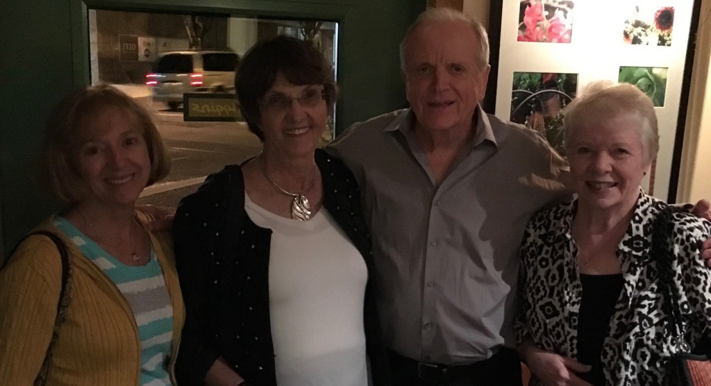
It took practically no coaxing to convince two of my California friends, Diana and Marguerite, to join me. They suggested we tack on a few days at the end of the kayaking program for them to show me some of their favorite sights in the Oregon/Washington area. We met in Portland early in September 2016. We spent a couple half days checking out the city, before heading to Skamokawa (more on its pronunciation later), Washington to begin our kayaking adventure.
P O R T L A N D
I had a mental picture of the city of Portland…. an artist hub; a farm-to-table “hip” food scene; a clean lifestyle; a world-famous beer culture; lots of bikers; rain, lots of rain and, like many large cities, a fairly large homeless population. The city’s motto said it all to me: Keep Portland Weird!
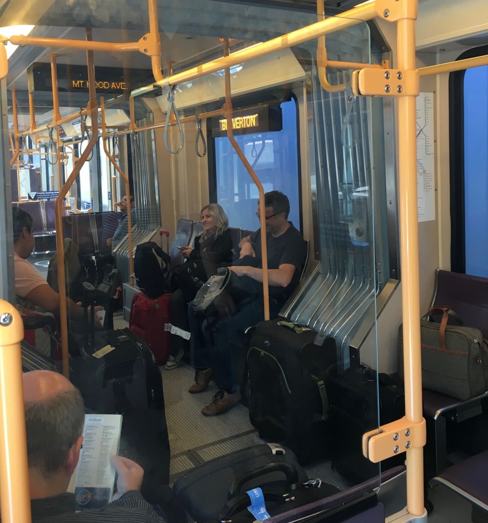
Portland’s excellent MAX light rail system’s Red Line took me directly from the airport to within two blocks of our downtown hotel – and it only cost $2.50!
…MAX has 97 stations with a weekday ridership between 115,000 and 130,000. The population of the Portland metro area is approximately 2.4 million, compared to Tampa Bay’s 2.9. To say it was an easy feat to build such a vibrant light rail system would be a mistake – not all supported the notion, nor the large capital outlay required; lots of heated rhetoric on either side of the issue. In the end, it was built and, to this outsider, it’s spectacular! In my humble opinion, time is long overdue for the various factions in my adopted hometown get together and address the public transportation issues here. I will now step off the soap box and continue this tale….
On my walk to the hotel down Oak Street, I passed an area with a dozen or so food trucks/carts. I’ve since learned this grouping is called a “pod”. Many of these pods dot the city. I might have stopped and sampled some of what they had to offer, but none were open early that Saturday afternoon – it looked like more of a weekday thing.
Portland is made up of several distinct Districts – each having its own claim to fame. We had a jam-packed next 24 hours to discover what makes Portland so “weird”! After meeting up with my friends, we hit the streets to explore the areas of interest close to our Downtown District hotel before dinner. Our first stop was the famed Powell’s City of Books, the flagship store of the largest independent chain of bookstores in the country – it’s enormous! It would take more than one weekend to browse the miles of book stacks – we spent only a short time there, just enough to get a feel of the place. We walked the streets skirting the Pearl and Chinatown Districts, before finding a sidewalk table at the Independent Bar & Grill – time for a snack and a glass of the grape. They serve draft wines from Coopers Hall, a local winery specializing in wines by the keg. Good stuff!
For dinner, three of us to met up with Bev (a Portland area native), whom I’d met on a trip to Yosemite earlier in the year. We had a great meal and wonderful conversation at Higgins, a Portland mainstay. After dinner, Bev took us for a spin around the city.
The next morning, we took to the streets once again! The downtown area offers a diverse collection of public art – below, a bronze bear feeds in a fountain.
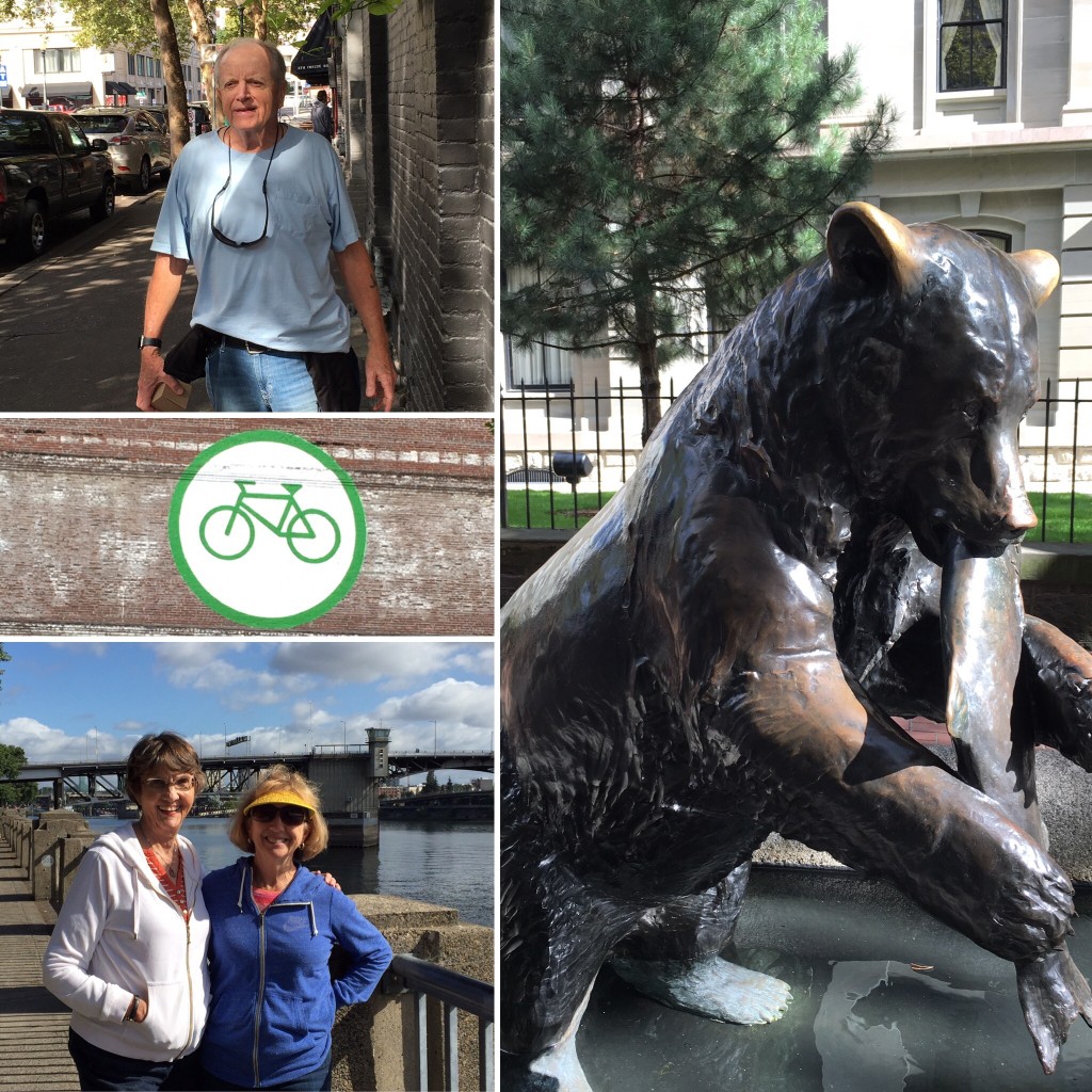
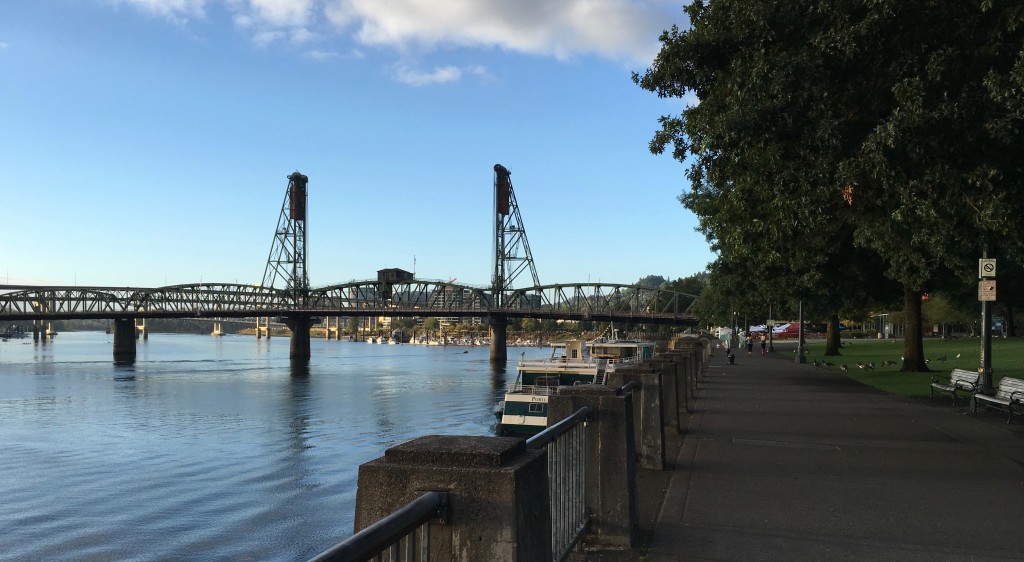
We found our way down to the river. The Willamette flows through downtown, just 12 miles from its confluence with the Columbia. The full Riverwalk is a 2.6 mile loop from the McCall Waterfront Park on the river’s west bank crossing via the Steel Bridge to the east bank and returning to the west bank via the Hawthorne Bridge. We confined ourselves to the west bank. Lots of walkers/runners out at that hour, as well as many Canadian geese feeding on the lawns! Preparations were being made for dragon boat races that would begin later in the morning. I couldn’t help but draw comparisons to Tampa. The Hillsborough flows through Tampa with many bridges crossing it; Tampa’s nascent Riverwalk is beginning to draw more people to the downtown area; regular dragon boat races are held and Tampa’s temperate weather is a big draw for northern college rowing teams to train on the river. There are some resident Canadian geese. However, egret, sandhill crane, dolphin and manatee are more plentiful!
Although the area is known for its rain, we had sunny skies and low humidity for the 24+ hours we spent in Portland. It was time to move on to Skamokawa, WA – the kayaks awaited!
S K A M O K A W A
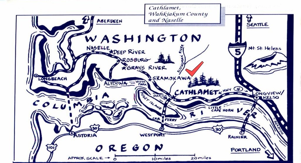
Wikipedia describes Skamokawa as “an unincorporated community in Wahkiakum County, Washington. The name is a Chinook term for smoke or fog on the water. It rests on the banks of the Columbia River. The town includes a post office, restaurant and general store, along with a nearby historical museum and covered bridge. It is a local center for kayaking and fishing”.
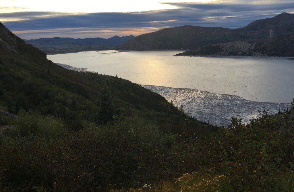
Wikipedia uses the standard pronunciation symbols. I prefer the way website Washington Placenames Pronunciation does it: ska-MOCK-away. I can’t tell you how many ways we butchered that name until it finally sank in. This map shows Skamokawa’s location on the lower Columbia river.
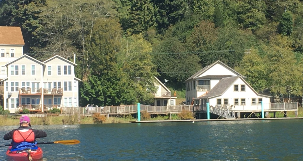
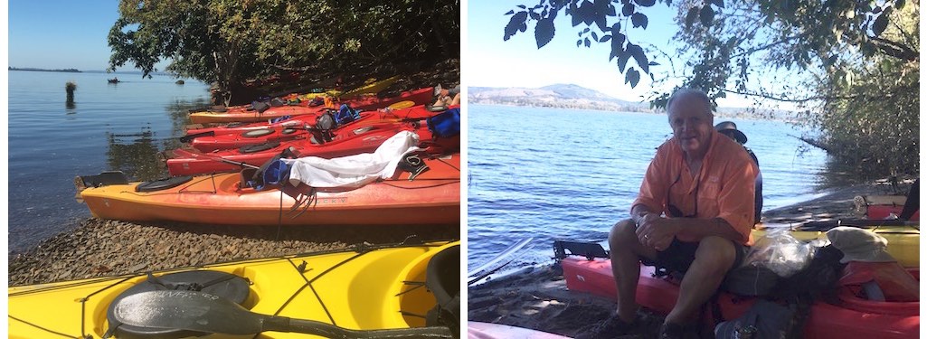
At the Skamokawa Resort, we checked in at the General Store. This place is perfectly located right on the water – it’s small (8 hotel rooms and 4 condos), but accommodated our group of 16 just fine. A well-stocked store; on-site meeting/dining room; very clean rooms. I snapped this photo of our lodgings on our last day of paddling.
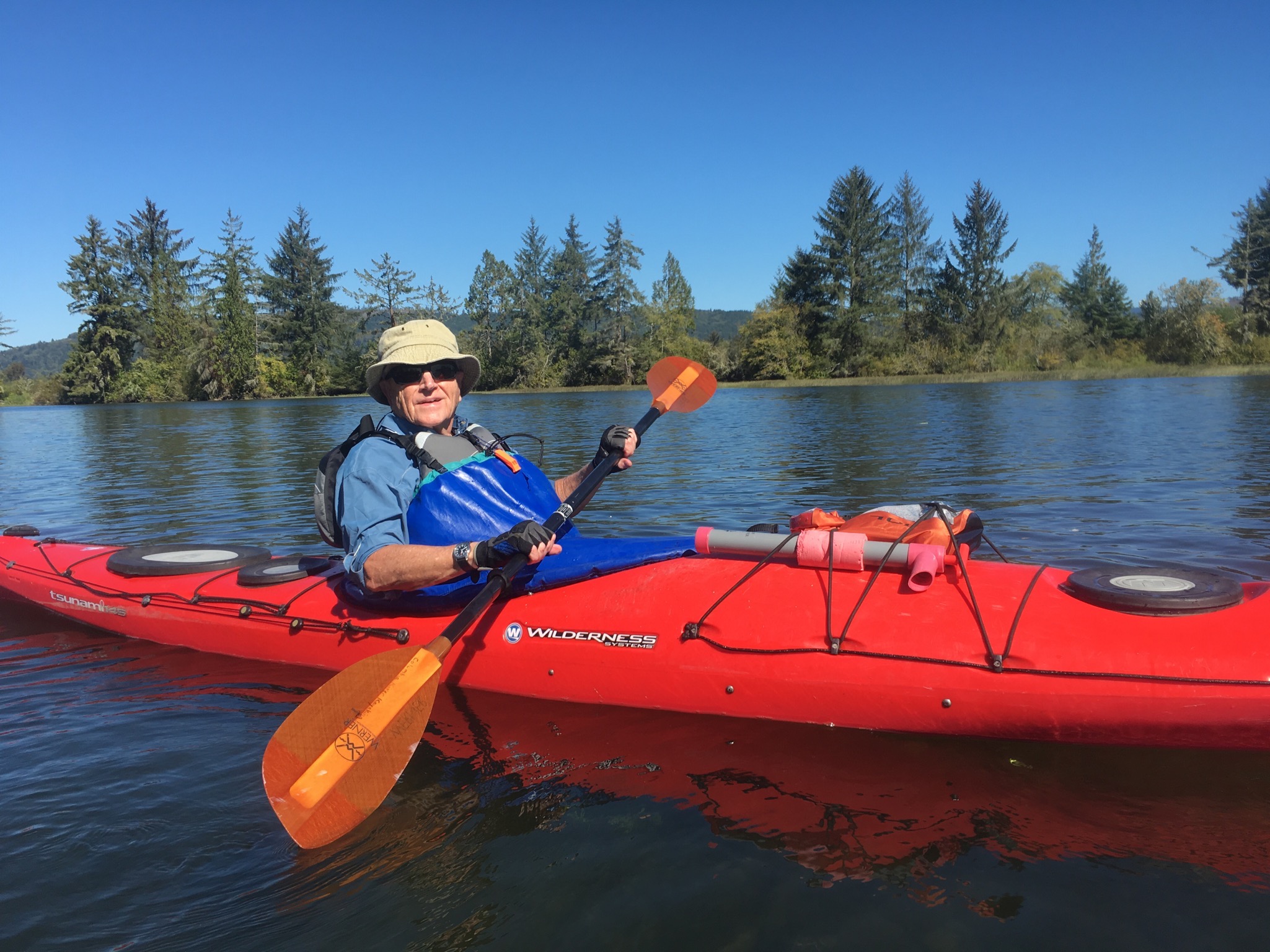
Columbia River Kayaking, the outfit with whom we were spending the next several days, was a short walk from the resort. We headed to their shop where we met our guides (Andrew, Kyleen & Andrew’s son Collin) and were fitted with vests, skirts and kayaks. We were all set for our first adventure that was to commence at 8:40 the following morning. Why not 8:30 or 8:45? Never asked!
At the dock in the morning, we suited up and received some some basic instructions from Andrew, our chief guide. One key piece of advice: “If you drop something overboard, do not try to lean over to retrieve it, or you will find yourself in the water!” Something I remembered on our 4th day. With help, we all safely made it into our kayaks without tipping over.
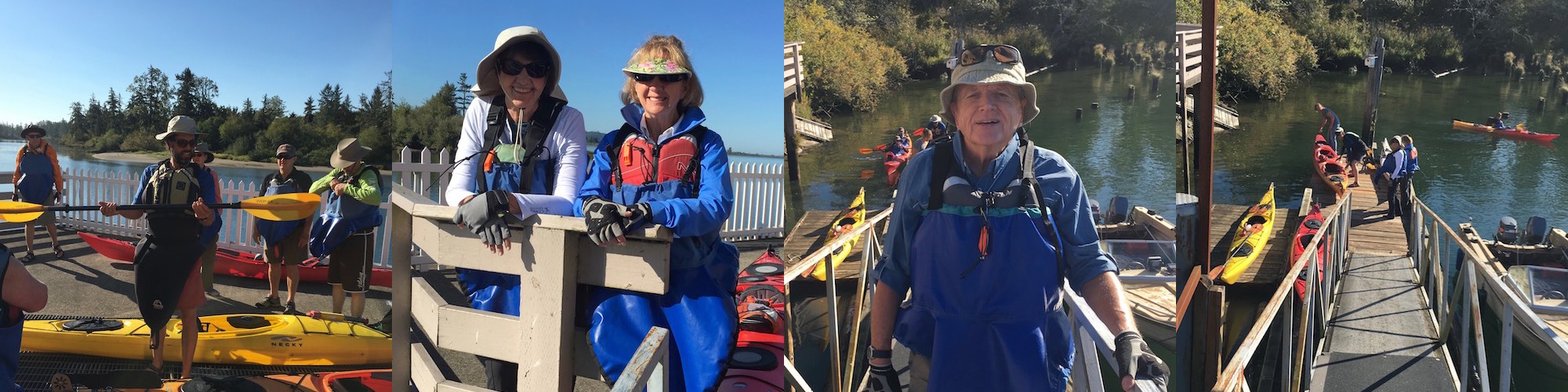
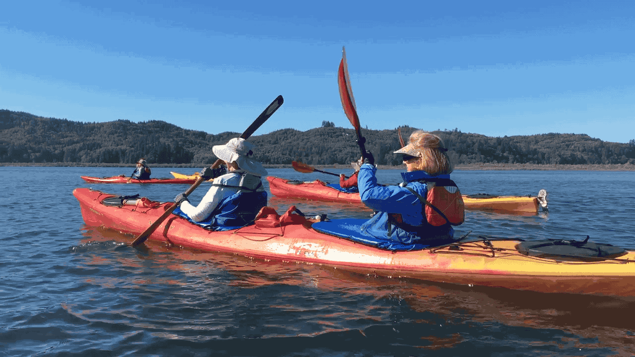
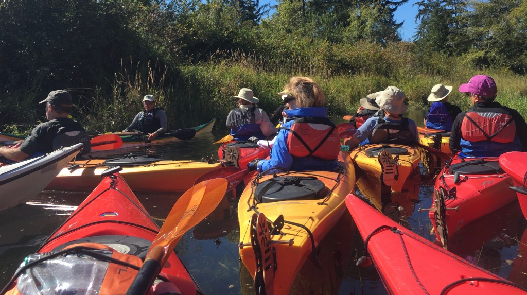
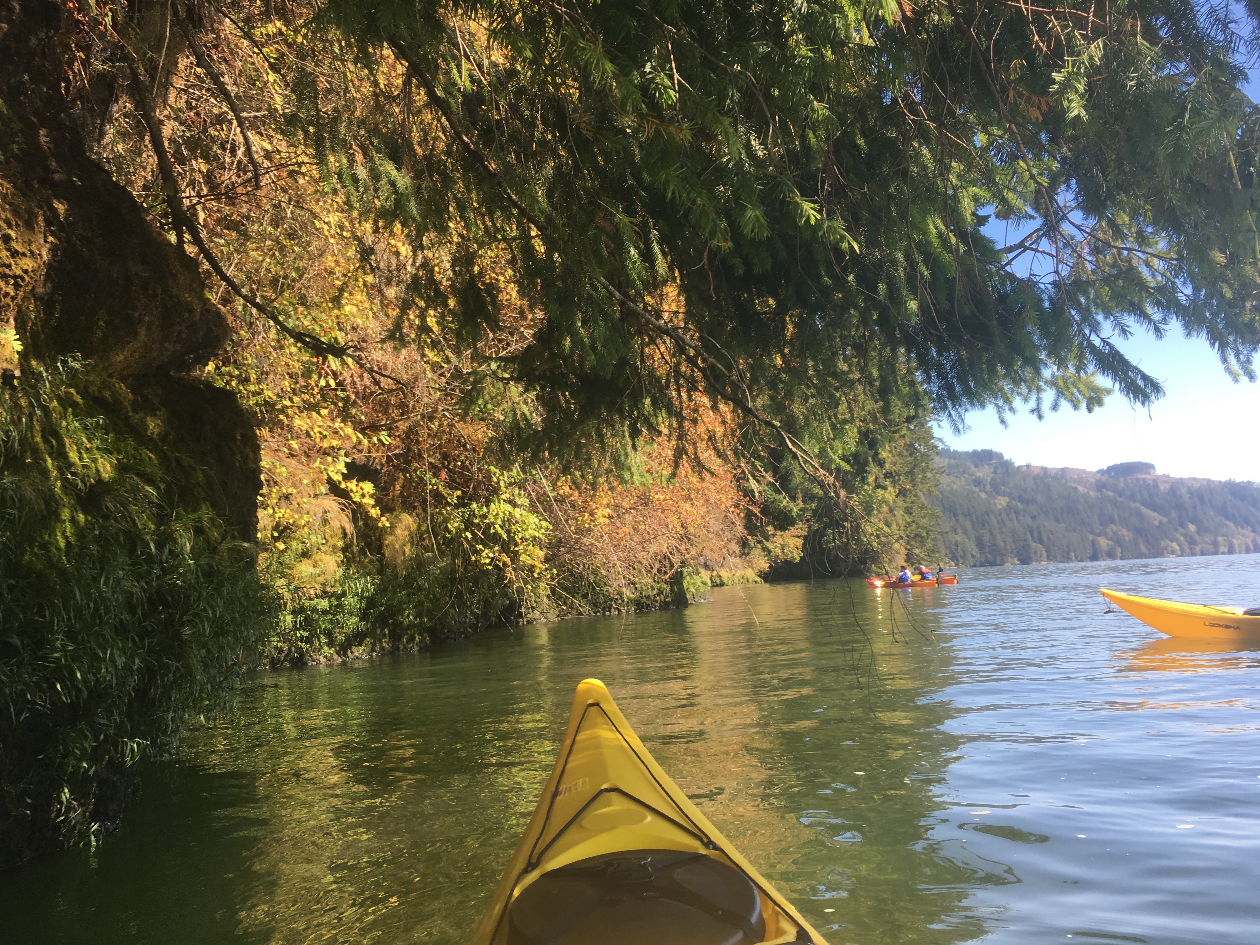
Most of us on this trip were inexperienced kayakers, so we spent the first 30 minutes practicing proper paddling techniques and generally getting a feel for being on the water. Once everyone was comfortable, off we went! Of the four full days we spent with Columbia River Kayaking, we were on the river three of those days. [More on the “off day” in a bit.] The three guides watched over the 16 of us like mother hens – most times one in front leading the way; one mid-pack and one bringing up the rear. I felt very safe, even though I had almost zero experience. Each day was a different route, with mostly calm waters – they attempted to plan the routes so we were with the tide for the most part. The weather was absolutely perfect – cool early mornings, warming as the day progressed; lots of sunshine.
A sampling of the three days on the water…
Each morning after breakfast, we made bag lunches to take with us on the day’s journey. Mid-day, we’d stop at a beach to rest, eat and use the restroom (“men, bushes to the left; women, bushes to the right!”).
Diana and Marguerite showing their good form.
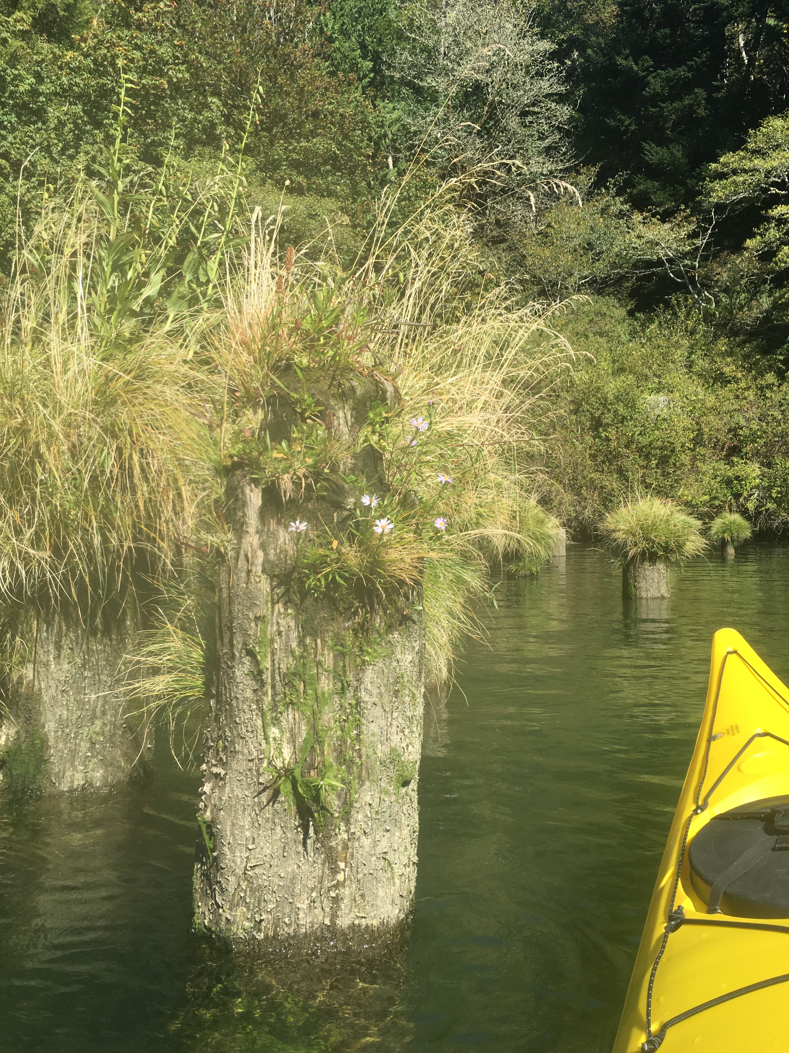
Pilings are all that remain of the salmon canneries that flourished in the area starting in the late 1800’s. Several reasons led to the steady decline of the industry through the early 1900’s. The final cannery in the county closed in 1947.
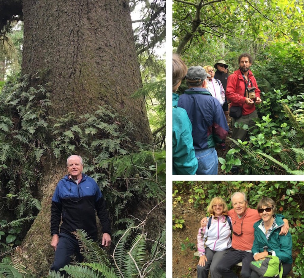
Our guides were extremely knowledgeable about the flora and fauna of the area, as well as the history of the region – including the time Lewis and Clark spent here toward the end of their trek west. We would stop along the way for impromptu lectures.
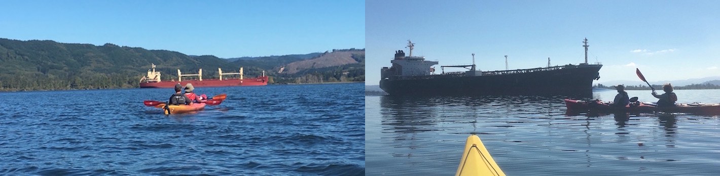
We encountered large cargo ships as we crossed the shipping channel. Our guides used radios to announce our presence – sometimes those giants were in the distance, others times very close!
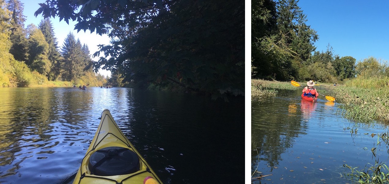
The most enjoyable paddling for me were the calm backwaters. So peaceful, with just the sounds of nature.
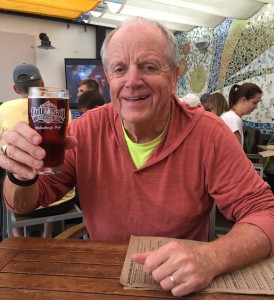
Shortly after taking this selfie, those expensive Maui Jim shades were fed to the fish! The neck strap, which I’ve had for a few years, finally gave out and overboard went the glasses. Remembering Andrew’s warning, I just waved them goodbye!

Our last paddle, along the rugged and varied north shoreline, was really special. The lush, mature douglas fir forest offered shade right over the water. A great way to end our kayaking adventure!
We were on the river for days 2, 3 and 5. On day 4, we took a break from kayaking to drive out to Cape Disappointment State Park, where the Columbia meets the Pacific Ocean.
On the way, we stopped at Knappton Cove near where the Lewis & Clark expedition became in danger of foundering within a few miles of its destination: the Pacific Ocean. A fierce storm forced them off the river and to hunker down in the cove. Clark named the spot “that dismal little nitch.” For six stormy days, the group was trapped by fierce wind and high waves at the rocky shoreline. Andrew and Kyleen read from the expedition Journals describing the situation.
Upon arriving at Cape Disappointment, we hiked the Coastal Forest Loop Trail, a 1.5 loop through lush vegetation and home to some very large Sitka spruce trees with their twisted, contorted branches above our heads. Ample stops along the way for Andrew to educate us on what we were seeing and experiencing. I saw my first huckleberry bush on that hike!
After a picnic lunch and a visit to the Lewis & Clark Interpretive Center, we hiked down to Waikiki Beach and this nice view of the lighthouse.

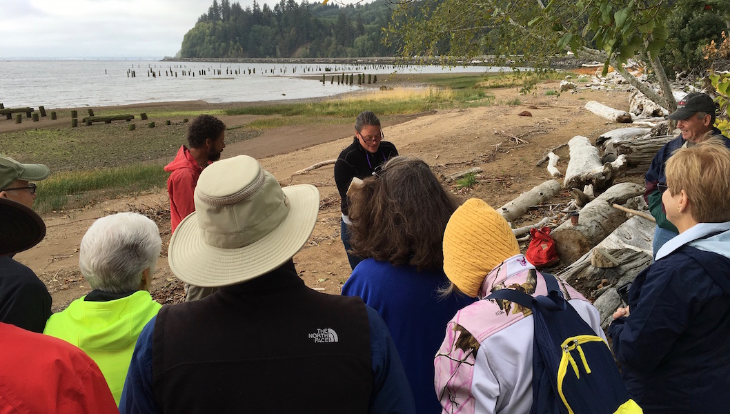
Each evening there was an educational segment. Two nights the Skamokawa Swamp Opera (which included two of our guides as members) entertained us with music of the region; another night Irene Martin, a local historian and author, gave us talk of the people of the region; another night Kyleen spoke about birds and waterfowl of Lower Columbia.
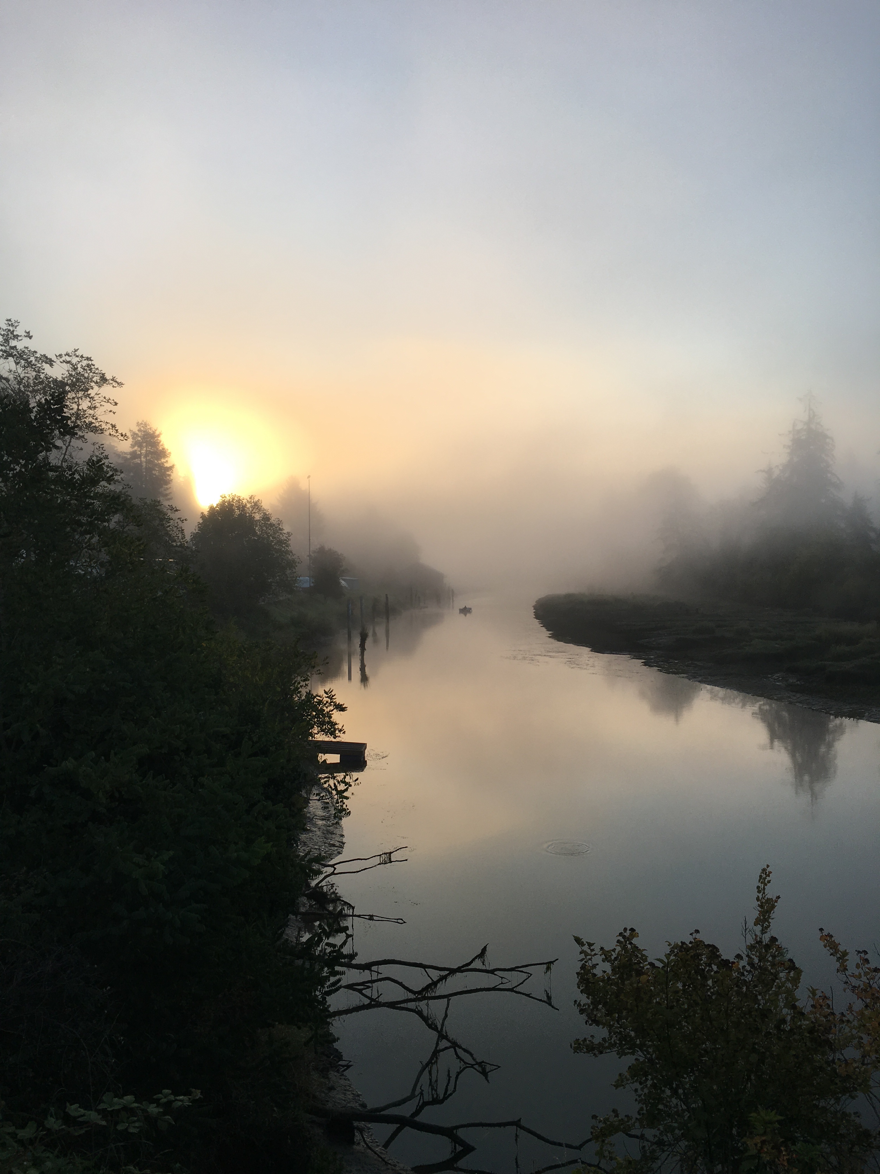
You’ll recall Wikipedia states the name Skamokawa is a Chinook term that means smoke or fog on the water. Some during the week said that may just be legend, with no basis in fact. On our first morning there, my internal clock was still on east coast time, so I was up early standing on the bridge near the resort. As the sun began to rise, I snapped this photo. I think there may be some truth to that legend!
Another great Road Scholar program!
With our adventure on the river over, Diana, Marguerite and I head off to Mt. St. Helens.
M O U N T S T. H E L E N S
According to NOAA, the eruption of Mount St. Helens on May 18, 1980 was “the deadliest and most economically destructive volcanic event in the history of the United States.” CBSNews reported “Fifty-seven people lost their lives in the eruption. The area’s abundant wildlife was also devastated. Some 7,000 big game animals and 12 million juvenile salmon were lost. No trees from a dense forest were left standing within 6 miles of the summit.” An incredible amount of damage!
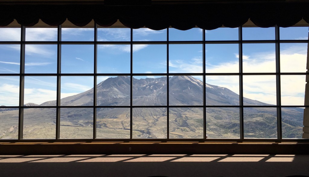
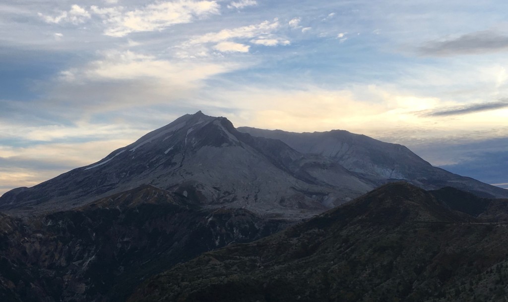
Now, more than 35 years since that violent eruption, the landscape surrounding Mount St. Helens continues to rebloom and recover – albeit slowly. We arrived at the Silverlake Visitors Center by late morning. After checking out the the interesting timeline-of-events displays, we pressed on to the Johnston Ridge Observatory. Here we had an up-close, unobstructed view of the mountain.
Clearly visible is the horseshoe-shaped crater remaining after 1300 feet of the peak blew off during the eruption.

Out on the plaza, we listened to a Park Ranger recount the minutes leading up to the eruption and describe the extent of the destruction after. The film was interesting, but the ending is what impressed me most. As the screen rose, so did the drapes behind it revealing this view.
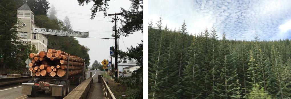
There was more we wanted to see so, after a quick food-cart lunch, we hit the road stopping at the Forest Learning Center – a partnership between Weyerhaeuser Company, Washington State Department of Transportation and the Rocky Mountain Elk Foundation. Weyerhaeuser owns/controls 13 million acres of private timberlands in the US and Canada, including much of the land around Mount St. Helens. The forest products industry is the second largest manufacturing sector in Washington state, after transportation (primarily aircraft) – and Weyerhaeuser is the major player. Timber harvesting is often a controversial issue. Those who have the business interests on one side and environmentalists on the other. When in Skamokawa we saw several examples of “clear cutting”, where every tree had been removed from a hillside leaving a pile of debris (slash) – and logging trucks frequently rolling through town on their way to the mills (photo left). It was informative to get the industry’s view here at the Learning Center and to see the results of their reforestation efforts since the eruption (photo right).
It took us a few hours to travel to the Windy Ridge viewpoint to see the mountain from the eastside.
From here we also had a great view of Spirit Lake. During the eruption, an avalanche swept the water out of the lake in an enormous tidal wave sending 600-foot waves crashing into a ridge north of the lake. The water rushed back into the basin stripping the slopes of trees, rock and soil. It changed the shape and elevation of the lake. The shattered trees that were deposited in the lake, remain as a floating log raft (and can be seen this photo) three decades after the event!
As you can probably tell in the two photos above, sunset was rapidly approaching – and we had several miles to go reach our lodging in Stevenson, WA. A couple we met here at Windy Ridge estimated we had a 3-hour drive. Long story, short version: We got a bit turned around on the dark, twisting roads through the Gifford Pinchot National Forest; missed a couple of turns and didn’t reach Stevenson until just before 1:00am, more than doubling that estimate! But we did have a memorable pre-midnight breakfast at Jollie’s Restaurant & Lounge, leaving us with stories to tell about the large female lead singer with the purple hair!
After a week of perfect weather, we awoke in the morning to rain. I guess a week of sun was more than we could have asked for in area known for its damp weather! After breakfast and a stop at a farmer’s market set up along Stevenson’s main street, we headed for the Bonneville Fish Hatchery and the co-located Bonneville Dam.
The hatchery is set in a nice wooded area with lots of man-made ponds, some featuring sturgeons up to six feet long! An interesting fact is that even after several years, the fish that are hatched here find their way back when they are ready to spawn – completing the life cycle.
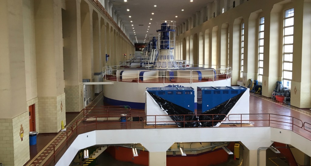
B O N N E V I L L E D A M
Straddling the Columbia River, the dam and locks were begun under FDR’s New Deal in the1930’s, with power production as its primary function (in addition to providing jobs for thousands during the great depression). Over the years additions have been made. Today it provides electricity for the equivalent of 500,000 homes.
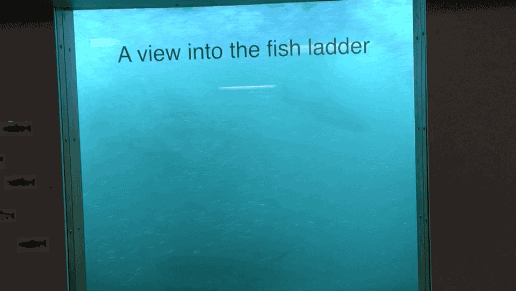
There’s a fascinating viewing window where you can actually see fish traversing the fish ladder to go upstream of the dam.
After a lunch stop at the Full Sail Brewery in Hood River, we traveled to the town of Government Camp and Mt. Hood.
M O U N T H O O D
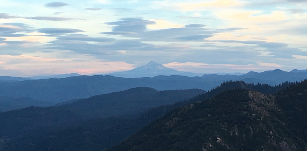
Unfortunately, because of the rain and low clouds, Mt. Hood was not visible during our stay there. This photo, shot the day before from the east side of Mount St. Helens, was the only time we were able to see it, even though from a distance. Still pretty striking!
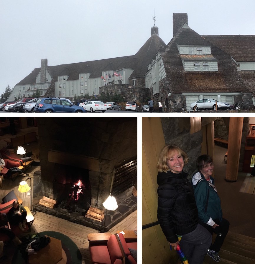
Another of FDR’s New Deal projects, Timberline Lodge was built on the slopes of Mt. Hood in the 1930’s using regional materials and resources, including local stone and timber. It was declared a National Historic Landmark in 1977. A driving rainstorm didn’t stop us that evening from venturing up to the lodge for drinks and dessert and returning the next morning to check things out in daylight.
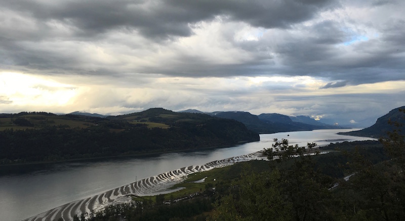
C O L U M B I A G O R G E
On the last day of our adventure, we left the interstate and took the Historic Columbia River Highway as it followed the river’s path. Built in the early 1900s to showcase the many waterfalls and other pieces of nature along the Columbia Gorge, it was a wonderful way to cap off the ten days.
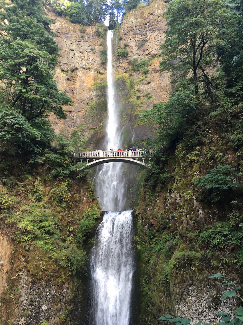
Multnomah Falls, the highest waterfall in Oregon.
S U M M A R Y
Another exceptional trip! Portland is a great city and not as weird as they’d like you to think it is! I’ve discovered that kayaking can be a very pleasant and peaceful way to enjoy nature. I’ve seen up-close how nature can take a violent turn – but, has a way of healing itself. This small taste of the Pacific Northwest has whet my appetite to see even more of it!